Covid Cross Day #27 Enderlin, ND to Gackle, ND
Covid Cross Day #27
June 30, 2020
Enderlin, ND to Gackle, ND 75 Miles
Start 8:02 AM Finish 2:16 PM
Ride Time 5:43
Ascent 1422 Feet
Descent 613 Feet
Tour Total 2348 Miles
I slept well last night camped in Patrick Pierce Park alongside the Maple River, outside of Enderlin. I got a full night's sleep. The freight trains and nearby grain elevator complex didn’t disturb me. It was warm and toasty inside my tent, and I didn’t need my sleeping bag. I slept on my Thermarest in my underwear. The bugs weren't bad, but I found a new bite this morning on my right wrist.
It was gray and 73°F when I hit the road. The forecast called for tailwinds and I was keeping my fingers crossed. I had a breakfast stop planned for twenty miles down the road, but decided last minute to stop at City View Fuel on my way out of Enderlin. I grabbed myself a Starbucks Frappuccino and a blueberry muffin. A little caffeine and sugar got me properly adjusted and ready for the morning ride. I was fully rested, freshly bathed, and had laundered clothing. Other than my wet, sweaty, disgusting gloves it was perfect riding conditions. Nothing but the wide open road.
On highway 46 I had a shoulder five feet wide between the white line and the gravel. There was a twelve inch rumble strip immediately to the right of the white line and an eighteen inch slant up from the gravel, leaving me thirty inches of level smooth riding surface down the center. There was a slight breeze behind me and I was averaging eighteen miles an hour with little effort. After three miles I encountered the roadwork that the bartender at Trio's had told me about last night. Two road workers had been in the bar eating their dinner. A sign said "Roadwork Next 19 Miles. Be Prepared to Stop".
I talked to the flagman and he told me to stay on the shoulder, and I’d be fine. There was new asphalt in the lane directly to the left of me, and the shoulder had just been oiled. A pilot car was bringing motor traffic through in the far lane in groups, and I was well separated from the moving traffic. Aside from the loose gravel and fresh tar smell, it was great! I finally came to where they were laying the fresh asphalt. There were several large pieces of road equipment. Trucks full of gravel mix were queued up ahead. After riding around the work area, I cut back over to the oiled shoulder and continued west. There was very little traffic.
Around me were endless fields of grass interspersed with ponds and marshes. The sparsely planted trees in North Dakota exist in pockets and in lines to protect farmsteads. The land had a slight roll and wasn't flat. I was at 1000 feet elevation and slowly climbing. I didn’t need to look at my digital map today. I was going in a straight line and could gauge where I was by the sparse highway crossings and geographical features. At a certain point the shoulder became a slant and there was only twelve inches between the rumble strip and the slant. The rumble strip was twelve inches wide, and had recently been oiled. I didn’t feel comfortable riding on it, so I rode to the left of the rumble strip and white line which was now buried beneath oil.
I turned around to go back and get a photograph and realized how much the wind was in my favor. I had dealt with a headwind on this stretch last year, when I had the pleasure of meeting a young high school senior by the name of Jack Linger. A North Carolina native, Jack was riding the Northern Tier west to east, and was stopping to interview people about their thoughts on the political climate. We stood on the side of the road and talked for a few minutes and afterwards stayed in touch. I got word last August that Jack had died, which I found troublesome. I was thinking about Jack Linger today. May his spirit live on!
I could spot Standing Rock Hill from a distance and recognized it. At 1480 feet it was the tallest feature around. Native Americans and early European explorers used it as a geographical marker. I then enjoyed a long lovely splendid downhill into the Sheyenne River Valley. I crossed the river and noticed the Little Yellowstone Park in the wide grassy valley. it was nice to experience some undulating topology. It had been days since I had been on a hill.
Back up on the other side of the valley, I passed a sign that said, "Continental Divide Elevation 1420'. It didn’t make any sense because I was still east of the Missouri River. I did some research to discover that there was a continental divide running east-west. The Sheyenne River empties into the Red River of the North, which drains into Lake Winnipeg, whose waters join the Nelson River and ultimately flow into Hudson Bay. The Missouri River and it's tributaries all drain into to the Gulf of Mexico.
I saw a touring cyclist coming towards me approaching from the west. Taylor was from from Seattle and doing the Northern Tier from Anacortes to Bar Harbor. He had stayed at the Honey Hub last night and was going to Enderlin. He mentioned that he was with others who were behind him. He had not run into Chris and Sidd. Taylor wasn’t happy about today’s wind situation. I told him that I had a headwind last year on this stretch. He said he preferred a headwind over bugs, which had been bad in Montana. He had ridden across Montana on the Hi-line. Having grown up in Washington State he was underwhelmed by the surroundings here.
I made it to City View Fuel & Cafe at the intersection of State Highway 1, right before the 10 AM breakfast cut-off. Last year, this place had been an amazing surprise. It wasn't listed on my maps, which warned of a seventy two mile gap in services. I had eggs over easy with wheat toast and bacon with orange juice and a Starbucks Frappuccino. After breakfast I ran into Taylor's companion Robert from Redmond Washington. He mentioned their third team member Kevin, who had called it quits in Bismarck. Robert mentioned that Logan pass through Glacier National Park had been closed because of COVID.
I was on grooved pavement with no white line and twelve inches of shoulder to the right of the rumble strips, which were hard to see because of the grooving. It was now 75°F and humid. It was forecast to rain tonight. Chris and Sidd were staying put because of storms out west, which Robert had also mentioned. I crossed County Road 61, the turn-off to Marion, which was a mile off route. It wasn't worth going off route. I passed a sign for a Weed Badger observation area another mile off route.
The rumble strips usually had breaks where I could enter and leave the shoulder. I got boxed in for miles. The deep rumble strips would rattle my fillings loose if I dared ride through them. Some of the shoulder was cracked with the long cracks running in the same direction that I was riding. I was worried about getting locked into the groove. The shoulder was narrow and crumbly, and eventually widened back out.
I caught a brief glimpse of a Weed Badger running alongside the shoulder. After the turn off to Adrian, no population listed, I rode a downhill into the James River Valley. I crossed a railroad track and the muddy stream, which was flowing south. It was a gentle climb back out of the valley. The panoramas were spectacular and I could see forever, miles and miles of rolling grassland, vast open nothingness, and beautiful space. WFMU's Duane Train was playing Dorothy Morrison's version of 'Spirit in the sky', and it was awesome! I could see US Highway 281 from a mile away. It would be the major highway crossing of the day. By 12:30 PM I was twenty one miles from Gackle.
On the next stretch of road the rumble strip consumed the width of the shoulder so I had to ride on or to the left of the white line. Farm equipment, wider than the road itself, came rolling down the highway. I felt like I was in a cloud and precipitation seemed inevitable. The birds were still sitting on the wires, and my weather app assured me the storm wouldn't hit until much later. It started to mist, and I noticed the birds had left the lines. I pulled over and turned on my lights and removed my sunglasses. It felt like the cloud was about twenty feet above me. The colors were brilliant. I was drawn to the North Dakota landscape. I noticed an eagle, an oriole, ducks, and a white pelican.
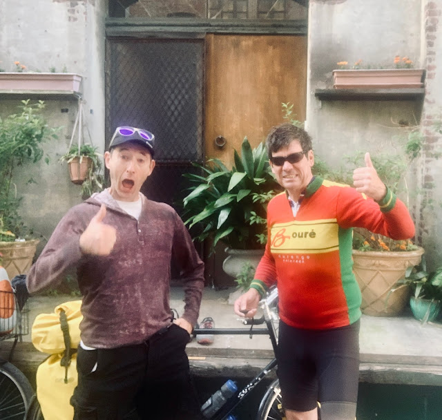
Several miles down the road I came to the Gackle welcome sign. As I approached the town I saw the familiar GACKLE spelled in car tires on a berm on the far side of the lake. The tires had been painted red white and blue. Last year they had been white. I rode into town and passed the town hall, the volunteer fire department, Dani's saloon, and the old movie theatre. I remembered how to get to the Honey Hub, and was in much better condition than when I arrived last year. Jason, the kind proprietor of the Honey Hub, was a beekeeper who brought his family here from Northern California every summer. The one room bike hostel was located in the basement of their house. There was a new above-ground swimming pool and deck this summer. His kids were lighting off fireworks. I noticed another Surly parked by the door. Touring cyclist John hailed from Steamboat Colorado, and was doing a tour from Darby, MT to Minneapolis.
I shaved, took a shower, and put my dirty laundry in the washing machine and dryer. I started editing today's report and taking advantage of the hostel's WiFi. John and I rode over to Dani's Place where I ordered a pizza a numerous bottle of Leinenkugel's. It started to thunderstorm outside, and I ran outside to cover my saddle. I finished the post before riding back to the hostel.


Comments
Post a Comment