Covid Cross Day #12 Xenia, OH to Losantville, IN
Covid Cross Day #12
June 13, 2020
Xenia, OH to Losantville, IN 96 Miles
Start 9:30 AM Finish 9:43 PM
Ride Time 8:46
Ascent 1386 Feet
Descent 1146 Feet
I had another great night's sleep last night at my uncle Herbie‘s house in Fort Thomas Kentucky. I had stayed up last night to edit a blog post and fell asleep around midnight. The room was dark and quiet, and the bed was firm. I woke up at 6:20 and took a shower and shaved. Herbie was in the kitchen when I got there. I had a bowl of cornflakes with sliced bananas, an orange juice, and a cup of instant coffee. I found my missing sock in the bottom of my rear left pannier, and I loaded everything including Herbie's brownies and a bag of cashews into my rear right pannier. We were able to fit my bicycle and equipment into the back of Herbie's van. It was great because I didn’t have to take the bike apart.
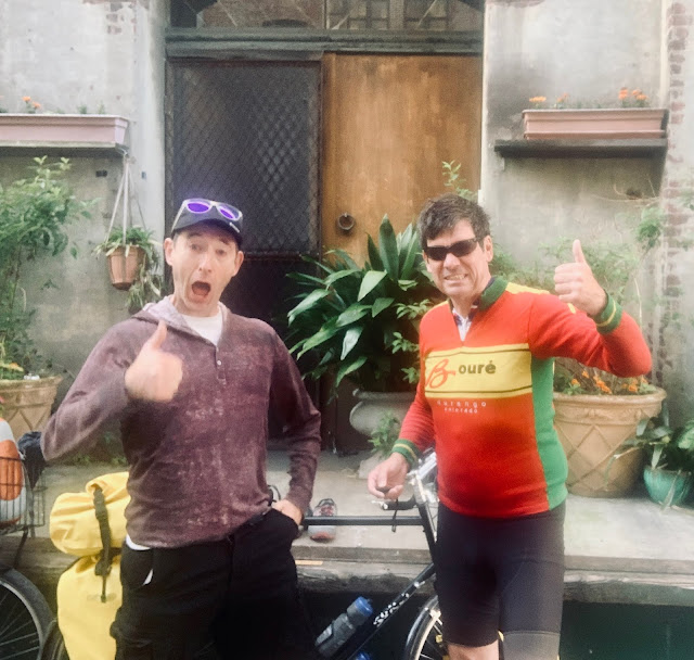
It was an hour ride back up to Xenia and we passed some familiar sites, such as the airport where I went skydiving in high school. Much of the area, though, had changed. In Xenia we pulled into a church parking lot trail side, where I had been two days earlier. I clipped my panniers and bags back onto my bike. Herbie took a picture, and I was back out on the road. I felt like a great burden had been lifted in Cincinnati. I got my mom's business affairs taken care of with Herbie's help. The memorial service for my mom was touching and meant a great deal to me. It was good to reconnect with my mom's community.
It felt odd to once again be alone riding down a trail through the middle of the woods. There were other cyclists including a recumbent tricycle and tandem as I sped around Xenia towards Dayton on the Creekside Trail. In Dayton I followed a trail along the Great Miami River where I crossed under numerous bridges and rode through the Five Rivers Fountain of Lights and Five Rivers MetroParks. There were five giant water jets blasting hight into the sky above me, and I got wet as I passed underneath. I passed numerous angry geese who tried to attack me on the trail.
There was construction work ahead and the trail was closed, but I proceeded ahead anyway. There were workers laying rebar for a new bridge span across the Great Miami. I walked my bike through the construction area and got sand in my shoes. I successfully made it around the work area and back to the path. I missed the bridge that I was supposed to go over, and had to turn around. I correctly crossed the Great Miami and then went the wrong way along the river, and had to turn around. Finally I was proceeding the correct way along the river and found myself in a construction zone from the same bridge project that I had dealt with earlier on the other side. Once again I went the wrong way. I finally ended up on the Wolf Creek Trail alongside Wolf Creek, when it began to rain.
I put on my rain jacket, including the hood. My feet got cold and I pulled over to put on my water proof socks. The rain was intermittent, and it was generally perfect weather for cycling. The trail ended at Trotwood where I had to go back out onto two-lane roads with narrow shoulders. I zigzagged around and got back on the Wolf Creek Trail to Brookville. As I neared the town, I spotted a classic giant ball on a golf-tee metal water tower. Brookville was painted on the side of the ball along with a blue stripe.
I passed north under I-70 and I couldn't exactly place the last time I had crossed it. I was now headed in a northwest direction. Fort Thomas would be the most southern point on the tour. After the interstate I branched off onto Salem Road and left the Wolf Creek Trail aka US Bicycle Route 50. I was now headed directly west. I rode through Lewisburg which featured Hometown Hero banners on every single telephone pole. Included were local veterans whom had served in in World War II, the Vietnam war, and the Middle East. It began to drizzle again, and I found myself back on US Bicycle Route 50. The corn here was twenty inches off the ground and the soybeans were six.
I passed over the first covered bridge of the tour. The Greeting Bridge was built in 1894. What a lovely treat! I was on a one-lane country road with cornfields to either side. There was no fencing, and groves of trees separated the farm properties. The sun was trying to break out but it remained gray and overcast. When the sun finally poked itself through, I pulled over to take off my rain jacket and apply sunscreen. I crossed back over I-70. I was on a one-lane country roads stair-stepping around fields. All the roads were straight lines with ninety degree turns. I was surrounded by fields of corn and grass, and could see on the map that I had crossed into the state of Indiana, the tour's seventh state. None of the state border crossings this year have had signs. There were no fences between the roadway and the fields. I crossed a set of railroad tracks right as a freight train was approaching. Immediately after I passed I could hear his horn blasting behind me.
Now that I was in Indiana, I was no longer seeing US Bicycle Route 50 signs. I noticed the generic green and white bike route signs that I assumed indicated US Bicycle Route 50. On my way into Richmond I passed the thousand mile mark. I was a quarter of the way to Portland. I was hungry and needed to eat. Richmond had beautiful old architecture, but the city has seen better days. The modern courthouse and government buildings were less interesting. There were fantastic bike lanes through the center of town. I stopped at Sheba’s where I was able to sit out on the back patio. The servers were all wearing masks. I ordered nachos, a burger, and two pints of Yuengling.
I got myself a little turned around trying to get out of Richmond and find the Cardinal Greenway Trail. I was now on the last map section of the ACA Chicago to New York City route. I would be taking the Indianapolis cut-off to Denver, IN where I’d get on the Northern Tier route that I took last summer. I’d be taking it west as far as Circle Montana. I crossed under I-70 for the last time. I was now headed northwest.
There were groups of young men out jogging on the trail who were all wearing black army T-shirts. There must have been a training facility nearby. The trail was tree-lined with cornfields beyond. It was a smooth asphalt surface with not a single crack from tree roots. The trail had parking lots and trail heads every five miles with restrooms, air pumps, and basic tools. I stopped in Williamsburg and sat at a picnic table to eat some brownies and edit blog posts. I saw several Amish people riding horse-drawn carriages.
I got completely caught up on my blog posts and then continued northwest on the rail trail. It was 8:30 PM and I still had an another hour of sunlight. The rail trail seemed to continue for dozens more miles. It was now considerably cooler, and I was wearing my rain jacket. I was headed due west and the sun was directly in my eyes. I was treated to a brilliant sunset. At the trailhead in Losantville I spotted a nice grassy area where I could set up my tent, camouflaged behind a tree. Before setting up camp, I rode over to One Stop Liquor to buy a six pack of Fat Tire. Dudes were shooting off loud mortars and plumes of black smoke were exploding in the sky.
I rode back to the trailhead and set up my camp without flashlights to avoid detection. There were houses not too far away. It was chilly out, and I sat at the picnic table editing this post and drinking beer. It was pitch black and the stars were brilliant.


Comments
Post a Comment