Covid Cross Day #43 Kamiah, ID to Clarkston, WA
Covid Cross Day #43
July 17, 2020
Kamiah, ID to Clarkston, WA 63 Miles
Start 6:38 AM Finish 4:49 PM
Ride Time 5:54
Ascent 245 Feet
Descent 654 Feet
Tour Total Miles 3501
I slept alright in my tent alongside the Clearwater River. The small sandy beach was pitched and I set up my tent parallel to the river. I slept partly on my Thermarest and partly on the sand to compensate for the slant. The occasional motor traffic from nearby US Highway 12 was loud. I was terrified that a car or truck would come crashing through the jersey barriers and land on top of me. In between were the pleasant rushing sounds of the river. In the morning I spotted the moon up above. It was a thin sliver and a glimmering star appeared between the open points, like the Turkish flag. I did my best to keep the sand out of my tent. It was fine sand, and I allowed as little as possible to stick to me. There was a fair amount of condensation clinging to all my gear this morning.
I had camped at mile marker 60, and it was a struggle to get back up the steep path to the road. I finally had to remove all my panniers and haul all my gear separately. The sun was to my back which was good for visibility. Unfortunately the shoulder between the white line and jersey barriers was in poor condition. In addition to all types of motor traffic, there were oncoming log trucks. The road wound between the rock cut and the river, and I was riding on the river side. The twisty-turvy highway was a bit harrowing and I turned on my rear flashing light to be safe.
The sun was strong and the air was crisp and cool. When I was riding in the shade of the valley I got chilly. When the sun was hitting my back it was perfect. Yesterday afternoon had gotten hot. I crossed 6 Mile Creek, and spotted a large C-clamp in the gravel. Instinctively, I almost slammed on my brakes. If I were home in New York, I would have grabbed it. I remembered once meeting a touring cyclist who was collecting tools that he found alongside the road. There was a train track on the other side of the river that was following the stream. At one point the river valley narrowed and I found myself in a tight canyon. I came to an opening and startled a deer and her fawn. They scrambled up the steep hill to get away.
A semi-truck hauling a pick up truck give me a thumbs-up honk. I came to a part of the road where there was no shoulder and a steep forty foot drop down to the river. It was gorgeous scenery, but treacherous. I needed to keep my eyes on the road, and wish there had been a better shoulder. At the fifty-two mile mark I spotted a large beach where others were camping. It was a much better spot than where I had spent the night, but it would’ve meant another eight miles of riding last night.
I stopped to look at an information plaque at Gold Rush Ferry. The ferry had once transported gold prospectors to a trail that climbed out of the canyon to rich gold fields discovered in 1860 in Pierce. I passed under a set of high-voltage power lines stretching across the valley. The top wire had large red balls to warn low flying aircraft. I met eastbound touring cyclists Sarah and Kylie from Utah whom had started in Astoria, and were riding the Lewis and Clark route to the Great Parks route. They had spent last night in Orofino and were going to Kooskia today. They were riding comparatively short days because they hadn’t trained for the tour, and were spending time to stop and enjoy the beautiful scenery. I was the first touring cyclist they had met, and they were psyched to make my acquaintance. Sara was blogging and featuring her tour-inspired watercolors on Instagram at: @saraaustin_art
I spotted a large grain elevator complex across the river. There were some freight train cars sitting out front. A flock of geese made a river landing right in front of me. I came to the turn off for Greer and kept going. I entered Clearwater County. I stopped to read a historical plaque about Lewis and Clark. This had been the spot where they finished their difficult mountain passage and descended to the river, which at this point was navigable for watercraft. They continued on horse and foot for another sixteen miles to where they found a campsite with trees suitable for making canoes.
I saw a large bird flying around with a fish in it's talons. At first I thought it had caught a rodent. I pulled over to watch it land up in a tree, and could clearly see fins. I passed the 'Welcome to Orofino' sign. I ventured to guess that Orofino, population 3,142, was named by an Italian prospector, who once found some fine gold around here. I rode over the bridge and crossed the river to get some breakfast. I noticed the Krystal Cafe where breakfast was served all day. There were TURD signs in the window, so I looked for a different place to eat. Unfortunately there were no other options, and I’m a whore for a good breakfast. I had eggs over-easy, bacon, toast, hash browns, orange juice, and coffee. There was TURD merchandise for sale, and propaganda about the pandemic being a hoax. The server was friendly and it was one of my best breakfasts yet. I sat next to a glass case that contained a stuffed alligator. Once again I found myself behind enemy lines. Before saddling up I snapped a photo of the banner in the front window. "Stop the COVID-19 Bull Shit!!! No more masks. No rubber gloves. No plastic shields. How long are we going to let the government take control over our lives?"
After breakfast I crossed back over the river and continued on my route. The crappy highway had four lanes of heavy traffic. After a few miles, the road finally tapered back down to two lanes. I entered Nez Perce County. The traffic and poor shoulder was making me a bit nervous. I spotted blackberries and stopped for a taste. I crossed Big Canyon Creek, and noticed a pick-up truck with a dead moose in the bed. I passed the turn-off for Lenore. There were large grass ridges across the river. I spotted cherry plums growing alongside the road, and stopped to enjoy them. I then crossed Cottonwood Creek. I noticed a collection of beehives in a field to the side of the road. I crossed over the Clearwater River, as the valley began to widen. At this point I was finally on a nice wide shoulder. There was bark scattered all over the shoulder from all of the logging trucks, and I enjoyed the smell of the timber.
I realized that I had crossed the river earlier than where the route had indicated, but it didn’t matter. I eventually found myself back on route where Highway 12 joined with Highway 95. There were now four lines of traffic. The valley opened up wide, and I could now see far reaching space to the west. I stopped at a Conoco station where masks were required, along with plexiglass dividers and dots on the floor. I got myself a Red Gatorade. Back on the road, I crossed Hatwai Creek and left the Nez Perce Indian Reservation. A bike trail began on the other side of the highway. It was adjacent to the motorized traffic but I had a guard rail in between. The path was filled with debris, but it was better than being out on the highway. At one point the path branched away from the highway, and there were pedestrians walking on it. In the far distance I could spot a huge factory and the town of Lewiston.
On my way into town I found myself riding atop a narrow flood wall. It was nice to be away from motorized traffic. It was the widest panorama I had experienced in several days. On the other side of the river I saw the giant Clearwater Paper Corporation, where there were ginormous mountains of wood chips. I crossed the Memorial Bridge back over the Clearwater River and into the center of Lewiston. I was greeted with a series of tubed archways that I rode underneath. I passed an old steam locomotive and then entered the sprawl. Lewiston was located at the convergence of the Clearwater and Snake Rivers. Across the Snake River was the smaller town of Clarkston. I pedaled through the center of Lewiston and then crossed a bridge over the Snake River and into Washington, the tour's 15th state.
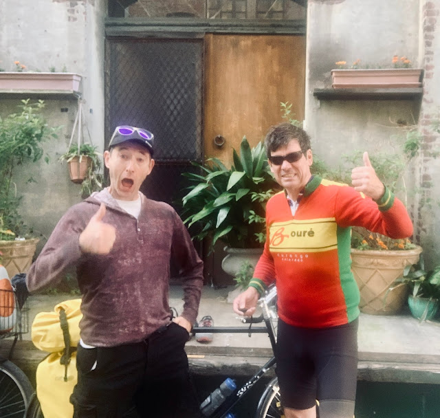
It was getting hot, and I pedaled over to Riverport Brewing, where I enjoyed several pints of River Rat Red. I rode over to nearby Roosters Waterfront Restaurant, where I picked up a cheeseburger and fries that I brought back to the brewery. I eventually pedaled over to the Best Western, where I had arranged to meet Henry & Linda from Team Spokane. I had met them last year in Glasgo, Montana on the Northern Tier Route, along with their friends Tim and Jeff. Henry & Linda were both physicians who practiced in Spokane. They were taking a week off from work to join me pedaling through desert headwinds and sleeping in ditches.
In my hotel room, I aired out my tent and equipment and then took a shower, shaved, and did laundry. As I was editing my report I could hear Henry & Linda's voices outside. They were joined by their son and his girlfriend, whom had driven them down from Spokane. It was so great so see them, and we elbow bumped. All five of us later walked over to Roosters, where I enjoyed fish tacos and more pints of River Rat Red. Before retiring to my room I walked over to CENEX to get a Modelo tall boy and a bag of Bugels. I ended up being too tired to finish the report.


Comments
Post a Comment